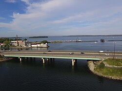
Tukey's Bridge
Appearance
Tukey's Bridge | |
|---|---|
 Tukey's Bridge from the west, above Back Cove | |
| Coordinates | 43°40′35″N 70°15′23″W / 43.6763°N 70.2565°W |
| Carries | Eight auto lanes; |
| Crosses | Back Cove |
| Locale | Portland, Maine |
| History | |
| Opened | 1960 |
| Location | |
 | |
Tukey's Bridge is a bridge connecting the neighborhoods of Munjoy Hill and East Deering in Portland, Maine. It is part of Interstate 295, U.S. Route 1, and Washington Avenue (State Route 26).
Back Cove Trail crosses the bridge on its western side.
History
[edit]Several bridges by the same name have existed connecting the areas.[1][2] The current bridge was completed in 1960 and named for Lemuel Tukey, a tavern owner and tax collector from the Back Cove area of Portland in the late 18th century.[3] It replaced a bridge completed around 1898, and which carried the Portland and Yarmouth Electric Railway.[4]
Further reading
[edit]References
[edit]- ^ History of Trains in Portland Archived 2011-06-11 at the Wayback Machine University of Southern Maine
- ^ Back Cove Bridge : Tukey's Bridge Archived 2012-07-13 at archive.today
- ^ I 295 Interstate-guide.com
- ^ Cummings, Osmond Richard (1957). Portland Railroad: Part I, historical development and operations. Connecticut Valley Chapter, National Railway Historical Society Inc. p. 16.
- "Tukey Bridge". Geographic Names Information System. United States Geological Survey, United States Department of the Interior. 30 September 1980. Retrieved 2010-11-03.
